Tracks of the StoneBear Copyright MCMLXIII Uncle Hargus ALL Rights reserved
ROF= Ring of fire Odyssey MEF-H = Marine Expeditionary Force- Hargus
YEL= Yellowstone Journey
Yellowstone Tracks of the StoneBear Red Lodge to Mammoth
Sept 09
Gardiner, Montana Yellowstone Nat pk North entrance gate
To Gardiner
for several days now have been driving to the east of Yellowstone. Had to drive The Chief Joseph Hwy / scenic byway,... then further north on The Beartooth Hwy / scenic byway... both absolutely beautiful Wyoming and Montana high country.
The Absoroka mountain range and the Beartooth mountain range.... snowcaps in many places. we're up at 7,000' + in many places. The Beartooth Hwy was 10,000' + in places ; That's the hwy... the mountains went on up to 12,000' The Beartooth has been called Americas most scenic drive... I believe it.
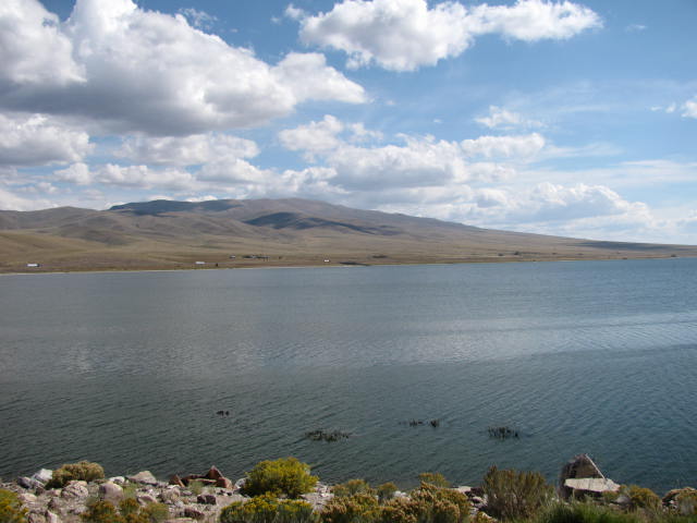
After a couple days in Red Lodge, Montana, headed for Yellowstone. but it will take a week or so from the stops in Big Timber, MT and Livingston, MT -- also see those posts--
Now we're heading south out of Livingston on Hwy 89s and the country is getting more beautiful every day. Closing in on Yellowstone I'm getting excited. I've waited a lifetime to see this. Driving down the valley with the Yellowstone River flowing is wonderful. Every few miles is even more spectacular scenery.
Arriving in Gardiner, Montana... right outside the North entrance gate to Yellowstone.... the small town is a hodge podge of small commercial businesses, outfitters, supply stores for fly fishing / kyaking / backpacking... this is outdoor country. Several restaurants in town to grab a bite.
The Lamar River flows into the Yellowstone River here. This is still Montana... the North Arch.... the majestic Northern entrance into Yellowstone is powerful to see. The inscription "For the benefit and enjoyment of the people" is center on the huge arch. How fitting. The cornerstone was laid by President Roosevelt in 1903 who was an outdoorsman and he loved the land. I have read in history books that President Roosevelt had a philosophy -- paraphrased... that the hard working men and women of America needed and deserved these outdoor recreation parks to refresh their soul -- I wish we had leaders that thought like that today. I'm glad these leaders preserved these parks for us.
Recently I have heard some campaigning that government doesn't create jobs. On the Tracks of the StoneBear journey, over a lifetime,... I have seen the stonework cabins, pavilions, structures built by the CCC and WPA... built 70 years ago. Some structures in national Parks like the Northern Arch of Yellowstone built 110 years ago... and they are still being used ... and ENJOYED by all visitors. These structures preserve and ARE our history.
The Northern Arch entrance-way / northern gate to Yellowstone.... within 2 miles into the park is the Wyoming state line... and a couple more miles to Mammoth Hot Springs. It's worth the journey to see this geological wonder. A good day !


Yellowstone Tracks of the StoneBear
Sept 09
Gardiner, Montana Yellowstone Nat pk North entrance gate
To Gardiner
for several days now have been driving to the east of Yellowstone. Had to drive The Chief Joseph Hwy / scenic byway,... then further north on The Beartooth Hwy / scenic byway... both absolutely beautiful Wyoming and Montana high country.
The Absoroka mountain range and the Beartooth mountain range.... snowcaps in many places. we're up at 7,000' + in many places. The Beartooth Hwy was 10,000' + in places ; That's the hwy... the mountains went on up to 12,000' The Beartooth has been called Americas most scenic drive... I believe it.
After a couple days in Red Lodge, Montana, headed for Yellowstone. but it will take a week or so from the stops in Big Timber, MT and Livingston, MT -- also see those posts--
Now we're heading south out of Livingston on Hwy 89s and the country is getting more beautiful every day. Closing in on Yellowstone I'm getting excited. I've waited a lifetime to see this. Driving down the valley with the Yellowstone River flowing is wonderful. Every few miles is even more spectacular scenery.
Arriving in Gardiner, Montana... right outside the North entrance gate to Yellowstone.... the small town is a hodge podge of small commercial businesses, outfitters, supply stores for fly fishing / kyaking / backpacking... this is outdoor country. Several restaurants in town to grab a bite.
The Lamar River flows into the Yellowstone River here. This is still Montana... the North Arch.... the majestic Northern entrance into Yellowstone is powerful to see. The inscription "For the benefit and enjoyment of the people" is center on the huge arch. How fitting. The cornerstone was laid by President Roosevelt in 1903 who was an outdoorsman and he loved the land. I have read in history books that President Roosevelt had a philosophy -- paraphrased... that the hard working men and women of America needed and deserved these outdoor recreation parks to refresh their soul -- I wish we had leaders that thought like that today. I'm glad these leaders preserved these parks for us.
Recently I have heard some campaining that government doesn't create jobs. On the Tracks of the StoneBear journey, over a lifetime,... I have seen the stonework cabins, pavilions, structures built by the CCC and WPA... built 70 years ago. Some structures in national Parks like the Northern Arch of Yellowstone built 110 years ago... and they are still being used ... and ENJOYED by all visitors. These structures preserve and ARE our history.
The Northern Arch entranceway / northern gate to Yellowstone.... within 2 miles into the park is the Wyoming state line... and a couple more miles to Mammoth Hot Springs. It's worth the journey to see this geological wonder. A good day !
You never drink twice from the same stream.
StoneBearTracks Copyright Uncle Hargus MCMLXIII ALL blog posts/photographs/video ALL Rights reserved
ALL Blog posts/photographs/video Copyright MCMLXIII ALL Rights Reserved