Dillon, Montana to Idaho Falls
en route to Dillon, MT Sept 09
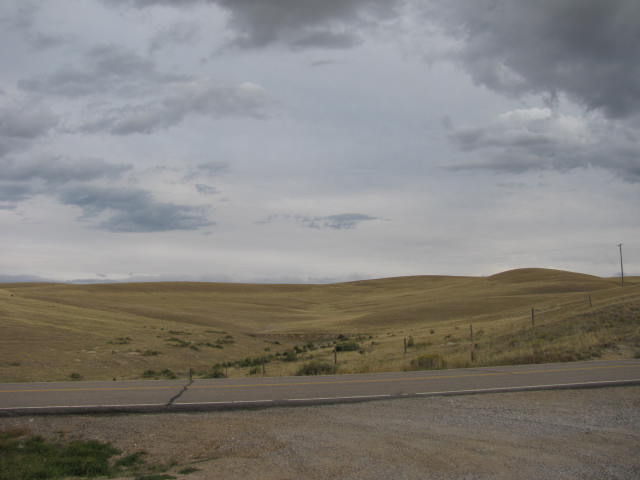
Beaverhead Rock Crossroads
Driving south from Twin Bridges, MT on Hwy 41s, heading to Dillon, MT, came across one of the geological transit points of the west; Beaverhead Rock.
For milleniums of time the native ancestral americans used this geological landmark before there were maps. This was the crossroads of the continental northwest.
To the North were the Flathead, the Pen d' orile, the Salish... The origin of dance awarded to these tribes after their 1st winter on earth . To the Northeast were the Blackfoot. To the East were the Nez Perce land and the Pacific further on. Yellowstone was to the Southeast , Shoshone territory and onto the plains to hunt bison. Beaverhead Rock was a main marker to travel in this northwest country. Crossroads.
And it was a significant place in Lewis and Clarks expedition:
****
from the National Park service website:
Sacagawea created much excitement on August 8, 1805, when she recognized Beaverhead Rock in the distance as the area in which her people, the Shoshones, had been when she was kidnapped as a child several years earlier. Lewis remembered in his journal:
. . . The Indian woman recognized the point of a high plain to our right which she informed us was not very distant from the summer retreat of her nation on a river beyond the mountains which runs to the west. this hill she says her nation calls the beaver's head from a conceived re[se]mblance of it's figure to the head of that animal. she assures us that we shall either find her people on this river or on the river immediately west of it's source; which from it's present size cannot be distant. as it is now all important with us to meet with those people as soon as possible I determined to proceed tomorrow with a small party to the source of the principal stream of this river and pass the mountains to the Columbia; and down that river untill I found the Indians; in short it is my resolution to find them or some others, who have horses if it should cause me a trip of one month. for without horses we shall be obliged to leave a great part of our stores, of which, it appears to me that we have a stock already sufficiently small for the length of the voyage before us . . . (DeVoto 1997, 181-182)
With Beaverhead Rock as their landmark, the explorers were confident they would soon find the Shoshone Indians. Lewis, Drouillard, John Shields and Hugh McNeal set out for Beaverhead Rock over land on August 9, 1805, to find the Shoshones while Clark and the rest of the men continued down the river. Contact between the Americans and Shoshone Indians was made three days later when Lewis stumbled upon an old Shoshone woman and two teenage girls. They were soon met by a party of 60 warriors on horseback led by Chief Cameahwait. After exchanging trinkets and signs of peace, the explorers set up camp with the Indians on the banks of the Lemhi River to await Clark and his companions. Throughout the next few days, Lewis learned much from Chief Cameahwait, most importantly that "he had understood from the persed nosed [Nez Perce] Indians who inhabit this river below the rocky mountains that it ran a great way toward the setting sun and finally lost itself in a great lake of water which was illy taisted" (DeVoto 1997, 211). Historian Stephen Ambrose explained the significance of this information: "For the first time, a white man had a map, however imperfect and imprecise, to connect the great rivers of the western empire."
Clark and his party arrived shortly after on August 17, 1805, after days of difficult navigation down the river; it was during this time that Clark stopped to make observations on the outcropping now known as Clark's Lookout. The arrival of Clark and the others was filled with excitement as Sacagawea suddenly recognized Chief Cameahwait as her brother and "instantly jummped up, and ran and embraced him, throwing over him her blanket and weeping profusely" (DeVoto 1997, 203). Chief Cameahwait and the Shoshone Indians traded with the explorers, supplying them with the horses necessary to continue. Sacagawea's ability to recognize Beaverhead Rock and direct the explorers to her people proved to be immensely helpful in the journey to the Pacific Ocean.
****
from Wikipedia:
Beaverhead Rock is a rock feature identified by Sacagawea during the Lewis and Clark Expedition as a landmark not distant from the summer retreat of her nation. According to the Journal of Lewis "the Indian woman recognized the point of a high plain to our right which she informed us was not very distant from the summer retreat of her nation on a river beyond the mountains which runs to the west. This hill she says her nation calls the Beaver's Head, from a conceived resemblance of its figure to the head of that animal...as it is now all important with us to meet with those people as soon as possible I determined to proceed tomorrow with a small party...and pass the mountains to the Columbia; and down that river until I found the Indians...without horses we shall be obliged to leave a great part of our stores..."
The rock itself is located 14 miles south of Twin Bridges on Montana 41 in Montana. The rock is part of Beaverhead Rock State Park, and is located on the Beaverhead River.
****
You come to this rock,... no compass, just the sun,... you know which way to head out. I stand in awe here.


Yellowstone Tracks of the StoneBear Dillon to ID Falls
Dillon, Montana to Idaho Falls
en route to Dillon, MT Sept 09
Beaverhead Rock Crossroads
Driving south from Twin Bridges, MT on Hwy 41s, heading to Dillon, MT, came across one of the geological transit points of the west; Beaverhead Rock.
For milleniums of time the native ancestral americans used this geological landmark before there were maps. This was the crossroads of the continental northwest.
To the North were the Flathead, the Pen d' orile, the Salish... The origin of dance awarded to these tribes after their 1st winter on earth . To the Northeast were the Blackfoot. To the East were the Nez Perce land and the Pacific further on. Yellowstone was to the Southeast , Shoshone territory and onto the plains to hunt bison. Beaverhead Rock was a main marker to travel in this northwest country. Crossroads.
And it was a significant place in Lewis and Clarks expedition:
****
from the National Park service website:
Sacagawea created much excitement on August 8, 1805, when she recognized Beaverhead Rock in the distance as the area in which her people, the Shoshones, had been when she was kidnapped as a child several years earlier. Lewis remembered in his journal:
. . . The Indian woman recognized the point of a high plain to our right which she informed us was not very distant from the summer retreat of her nation on a river beyond the mountains which runs to the west. this hill she says her nation calls the beaver's head from a conceived re[se]mblance of it's figure to the head of that animal. she assures us that we shall either find her people on this river or on the river immediately west of it's source; which from it's present size cannot be distant. as it is now all important with us to meet with those people as soon as possible I determined to proceed tomorrow with a small party to the source of the principal stream of this river and pass the mountains to the Columbia; and down that river untill I found the Indians; in short it is my resolution to find them or some others, who have horses if it should cause me a trip of one month. for without horses we shall be obliged to leave a great part of our stores, of which, it appears to me that we have a stock already sufficiently small for the length of the voyage before us . . . (DeVoto 1997, 181-182)
With Beaverhead Rock as their landmark, the explorers were confident they would soon find the Shoshone Indians. Lewis, Drouillard, John Shields and Hugh McNeal set out for Beaverhead Rock over land on August 9, 1805, to find the Shoshones while Clark and the rest of the men continued down the river. Contact between the Americans and Shoshone Indians was made three days later when Lewis stumbled upon an old Shoshone woman and two teenage girls. They were soon met by a party of 60 warriors on horseback led by Chief Cameahwait. After exchanging trinkets and signs of peace, the explorers set up camp with the Indians on the banks of the Lemhi River to await Clark and his companions. Throughout the next few days, Lewis learned much from Chief Cameahwait, most importantly that "he had understood from the persed nosed [Nez Perce] Indians who inhabit this river below the rocky mountains that it ran a great way toward the setting sun and finally lost itself in a great lake of water which was illy taisted" (DeVoto 1997, 211). Historian Stephen Ambrose explained the significance of this information: "For the first time, a white man had a map, however imperfect and imprecise, to connect the great rivers of the western empire."
Clark and his party arrived shortly after on August 17, 1805, after days of difficult navigation down the river; it was during this time that Clark stopped to make observations on the outcropping now known as Clark's Lookout. The arrival of Clark and the others was filled with excitement as Sacagawea suddenly recognized Chief Cameahwait as her brother and "instantly jummped up, and ran and embraced him, throwing over him her blanket and weeping profusely" (DeVoto 1997, 203). Chief Cameahwait and the Shoshone Indians traded with the explorers, supplying them with the horses necessary to continue. Sacagawea's ability to recognize Beaverhead Rock and direct the explorers to her people proved to be immensely helpful in the journey to the Pacific Ocean.
****
from Wikipedia:
Beaverhead Rock is a rock feature identified by Sacagawea during the Lewis and Clark Expedition as a landmark not distant from the summer retreat of her nation. According to the Journal of Lewis "the Indian woman recognized the point of a high plain to our right which she informed us was not very distant from the summer retreat of her nation on a river beyond the mountains which runs to the west. This hill she says her nation calls the Beaver's Head, from a conceived resemblance of its figure to the head of that animal...as it is now all important with us to meet with those people as soon as possible I determined to proceed tomorrow with a small party...and pass the mountains to the Columbia; and down that river until I found the Indians...without horses we shall be obliged to leave a great part of our stores..."
The rock itself is located 14 miles south of Twin Bridges on Montana 41 in Montana. The rock is part of Beaverhead Rock State Park, and is located on the Beaverhead River.
****
You come to this rock,... no compass, just the sun,... you know which way to head out. I stand in awe here.